It was one of those cloudless, gorgeous days out of the book...90-ish degrees, we are just told on the TV weather, and we will have the same tomorrow and for the rest of the week, apparently.
What an interesting and beautiful day it was....Firstly, the vegetation changed. Then the water was the most wonderful color...while we were in the Sounds...in the marshes, it was still very Tanin heavy and brown!

Even the Dolphin look brown!


We couldn't leave the dock at Darien until the tide was on the high rise. That meant about 11am. It was a good time to leave, and it gave us time to go for a walk and take some photos..last ones:) We have really enjoyed our weekend there, so we also went by the office of development, or whatever that is, and said thanks for the free dock and some suggestions for how they could make others welcome!
The light was pretty, of course...given the day! We went back to the vacant former Movie Theatre to take morning light photos. Shame about the wires, but they lend an abstract air to the pic.:)

Broad Street, on Monday morning. Nothing open until 10am! That's the kind of hour I think is civilized!


It took us an hour to go down the Darien River to the cross-roads to rejoin the ICW. We had watched the little cruise ship go north up the same channel in front of us. and later saw it parked next to Sapelo Island, as we went up the channel past Little Sapelo Island...see chart below.
Three Sounds, today. These Sounds are the confluence of several rivers all opening onto the largest river which opens to the Atlantic Ocean. It is the widest/largest body of water. The first was Sapelo Sound, which followed our passage up the river alongside Little Sapelo Island, which is next to Sapelo Island, which is on the Atlantic Ocean. Make sense?
Let me illustrate this.. That is Sapelo Island on the right where it says Marsh Landing.

I apologise in advance for the photos and charts. When we are in the marshes, there really is nothing to see!..well, apart from Marshes! This is how much of the journey looked, today...one river, into another, along a narrow channel that we had anticipated might be shallow, but seemed to have been recently dredged, it was so deep. I think the shallowest point was 7ft! Not as bad as we expected!

Lots of marshes, Islands, and rivers.

You can see the little cruise ship on the far right! ..this dock is on Little Sapelo Island...about all we could see of signs of life!

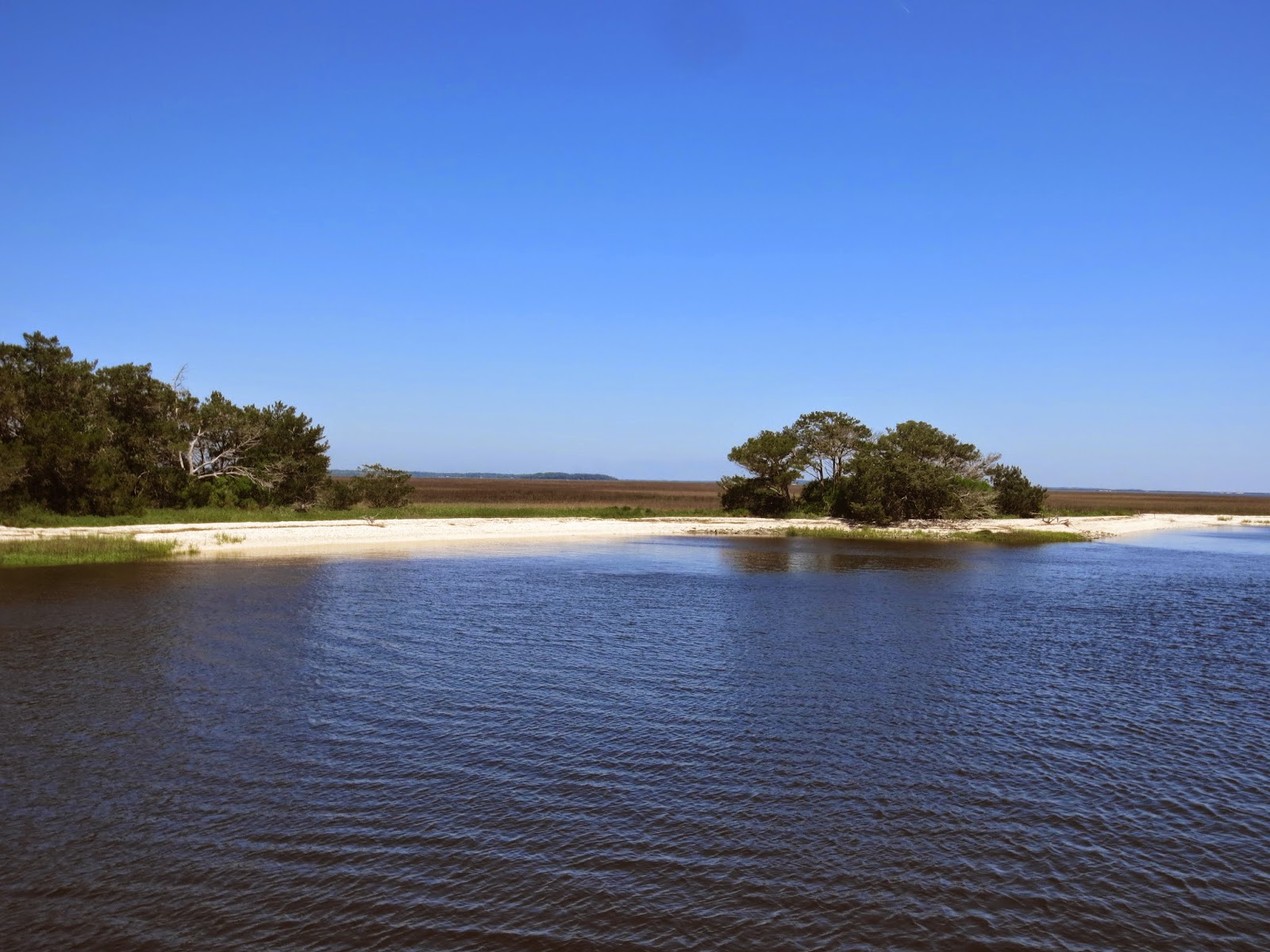
Isnt this gorgeous? We just felt that we would like to run the boat into the beach and hop off.

You can see where we came out of the river and are now in the Sound and making our way towards another river off to the right.

The first Sound..Doboy Sound!

 Waz is pointing to where we were at the time. You can see how close we are to the Atlantic Ocean!
Sorry, not a clear photo! This shows the really narrow channel...follow the red boxes around and into the white oblong at the top which is a marked channel.


I wonder who thought of the name Dog Hammock Spit?? on the top right.

The bottom of St Catherine's Sound was interesting...see the left hand side of the screen shot just below 24.5ft. up and down and then it levelled out.

We turned left yet again, this time from St Catherine's Sound..if you go all the way to the right, you will get to the Ocean. The yellow arrows (Bottom of the screen, right) indicate strong current...you think? Tidal currents going in and out and coming from all directions into that one large body of water!???:)

7 hours of motoring is a long time, and covers a lot of water. Some of the time we are in the middle of a wide body of it, and at other times we feel we could almost reach out and touch the sides. We like the changes, and in the middle of the Sounds today, put our feet up and relaxed and thought we might enjoy living in these surroundings. The water wasn't VERY deep, but 38 ft is enough for fun, in our books. We had enough room to relax and enjoy our surroundings, for at least an hour of travel.
I have to leave you here, today, as there is decreasing bandwidth on our WiFi booster, and it takes a lot to up load all the photos. I don't want to run out before the 16th of the month.
We dropped anchor in the Marshes again...I love it..so tranquil! and we have enough water under us at low tide, not to worry about a thing. Im sure we will sleep well!
Ciao for now.
No comments:
Post a Comment